#include <video_streamer_c_api.h>
Classes | |
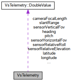
| struct | DoubleValue |
Public Attributes | |
| const char * | missionId = nullptr |
| const char * | platformDesignation = nullptr |
| const char * | cameraManufacturer = nullptr |
| const char * | cameraModel = nullptr |
| DoubleValue | heading |
| DoubleValue | pitch |
| DoubleValue | roll |
| DoubleValue | latitude |
| DoubleValue | longitude |
| DoubleValue | altitude |
| DoubleValue | sensorHorizontalFov |
| DoubleValue | sensorVerticalFov |
| DoubleValue | sensorRelativeAzimuth |
| DoubleValue | sensorRelativeElevation |
| DoubleValue | sensorRelativeRoll |
| DoubleValue | slantRange |
| DoubleValue | cameraFocalLength |
Detailed Description
Updated telemetry data block. Any fields can be empty, only non-empty values are sent in next metadata packet. String fields are empty when null, double values are empty when isPresent flag is false. All fields correspond to ST 0601.13 defined fields, see there for additional details.
Member Data Documentation
◆ altitude
| DoubleValue VsTelemetry::altitude |
Sensor true altitude, meters.
◆ cameraFocalLength
| DoubleValue VsTelemetry::cameraFocalLength |
In millimeters.
◆ heading
| DoubleValue VsTelemetry::heading |
Platform heading angle, relative between longitudinal axis and True North measured in the horizontal plane, radians. Range: [0; 2*PI].
◆ latitude
| DoubleValue VsTelemetry::latitude |
Sensor coordinates, rad.
◆ pitch
| DoubleValue VsTelemetry::pitch |
Platform pitch angle, angle between longitudinal axis and horizontal plane, radians. Only angle in range (-20; 20) degrees is properly transferred, other values are transferred as "out of range" indicator.
◆ roll
| DoubleValue VsTelemetry::roll |
Platform roll angle, angle between transverse axis and transverse-longitudinal plane, radians. Positive angles for lowered right wing. Only angle in range (-50; 50) degrees is properly transferred, other values are transferred as "out of range" indicator.
◆ sensorHorizontalFov
| DoubleValue VsTelemetry::sensorHorizontalFov |
Sensor horizontal field of view angle, radians. Range: [0; PI].
◆ sensorRelativeAzimuth
| DoubleValue VsTelemetry::sensorRelativeAzimuth |
Sensor relative azimuth angle, radians. Rotation angle between platform longitudinal axis and camera pointing direction as seen from above the platform. Range: [0; 2*PI].
◆ sensorRelativeElevation
| DoubleValue VsTelemetry::sensorRelativeElevation |
Sensor relative elevation angle, radians. Relative elevation angle of sensor to platform longitudinal-transverse plane, negative angles down. Range: [-PI; PI].
◆ sensorRelativeRoll
| DoubleValue VsTelemetry::sensorRelativeRoll |
Relative roll angle of sensor to aircraft platform, radians. Top of image is zero degrees. Positive angles are clockwise when looking from behind camera. Range: [0; 2*PI].
◆ sensorVerticalFov
| DoubleValue VsTelemetry::sensorVerticalFov |
Sensor vertical field of view angle, radians.Range: [0; PI].
◆ slantRange
| DoubleValue VsTelemetry::slantRange |
Slant range, meters.
The documentation for this struct was generated from the following file:
- /home/artyom/workspace/ugcs-video-streamer/misp_streamer/src/main/cpp/include/video_streamer_c_api.h